A special edition of The Patient Work
Every Labor Day weekend, my husband and I retreat to the San Bernardino National Forest. The tradition began as a way to escape the late-summer heat and get in a mountain hike. Over time, I started anticipating the drive as much as the destination. In a little more than an hour, the road climbs more than 5,000 feet from the city of Highland to Big Bear Lake, moving from lower-elevation chaparral into oak woodland and, finally, montane forest.
Most installments of The Patient Work watch one place change through time. For this special edition, I wanted to follow ecological change through space. We planned two days: one at the top, exploring Big Bear Lake and the surrounding forest, and one making a slow descent, stopping whenever the vegetation changed enough to demand our attention.
The result was a vertical calendar: five stops across roughly 4,550 feet, from Big Bear and Fawnskin to the City Creek Fire Station. Elevation was only part of what we were seeing. Slope, exposure, water, geology and recent fire also shaped each site. Still, the descent offered an unusually compact view of deep summer across the upper Santa Ana River watershed.
Stop One: Big Bear and Fawnskin 6,844 feet
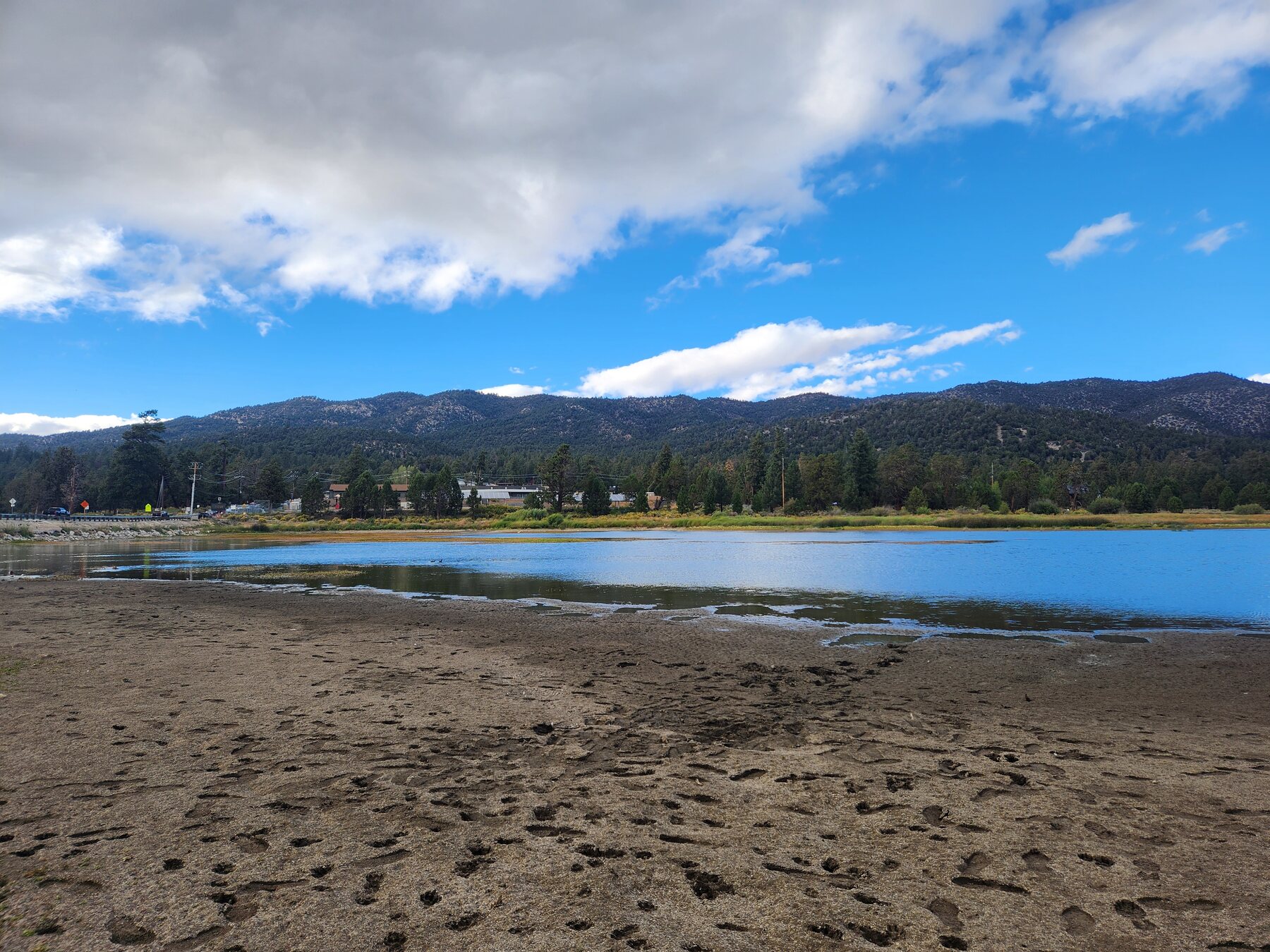
Maybe it was the altitude, or perhaps the winding ride up the mountain, but by our first morning I had entered a state of unusual serenity. I abandoned plans for a difficult hike and spent the morning meandering along the shore of Big Bear Lake instead. Mallards bobbed in the choppy water while I hunted for driftwood. Gusts drove whitecaps across the lake. Flocks of chickadees fought the headwind near shore, while four American white pelicans sailed into it with considerably more dignity.
The lake itself was a deep, opaque green. Posted warnings advised visitors against drinking the water, even after filtering or boiling it. A local told us that late-summer blooms were familiar: heat, abundant sun and lower water levels can create favorable conditions for algae. Families still lined the shore with fishing poles, but the signs and the color of the water made me uneasy.
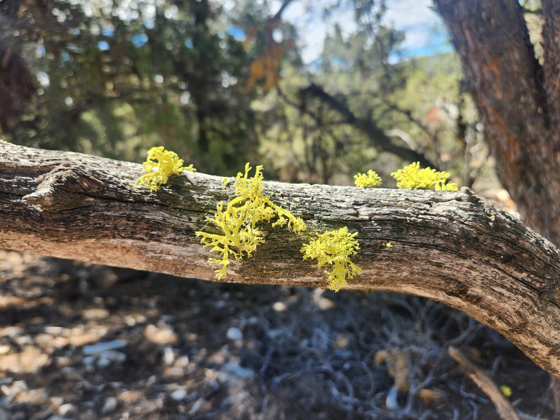
By afternoon, storm clouds had begun to assemble. We followed the Cougar Crest Trail toward the Big Bear Discovery Center through stands of Jeffrey pine and western juniper. The junipers were heavy with silvery-blue berry-like cones, and several sun-facing branches hosted wolf lichen. Its bushy, lime-green growth seemed to illuminate the boughs from within. Mountain mahogany, low manzanita and occasional patches of blue sage filled the understory. Along the way, we were even greeted by a sleek Steller’s Jay who regaled us with a lively bout of sharp calls before departing through the woods.
 © Lindsey Thome
Throughout our trek I kept looking for a bald eagle, hoping to see Shadow or one of his offspring. I wasn’t that fortunate this time. However, we did see small tributes to Jackie the bald eagle, who recently passed away from injuries sustained during an altercation with two juvenile eagles. Our family had watched her for years on the Friends of Big Bear Valley nest camera as she tended eggs through rain and snow and defended her eaglets from danger. As a new mom raising my own kiddo, I felt a kinship with Jackie as I watched her tirelessly tend to her nest, her partner, and her babies. I smiled to myself as I thought about how her offspring might build their own aeries in these sturdy Jeffrey pines one day.
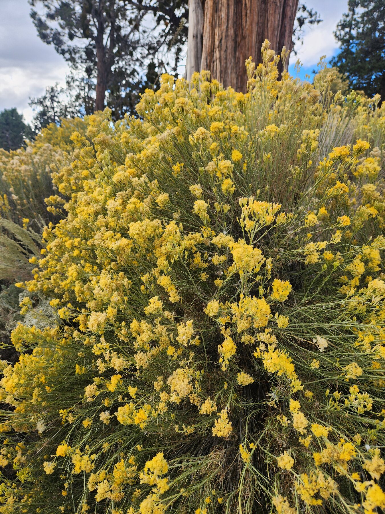
And I couldn’t wrap up an account of day one without a special shout-out to the unsung botanical hero of the deep-summer montane forest—the rubber rabbitbrush. Cougar Crest’s south-facing slopes are pummeled by sunlight all summer long. Pine needles and pine cones are littered across the forest floor, creating a golden layer radiating heat. Few plants could flower so exuberantly in these conditions—hot, dry, late summer and smothered in pine needles—but there was the humble rubber rabbitbrush lighting up the mountainside with its profuse, bright yellow floral displays, like large bouquets of captured sun—a welcome blaze of color in the September forest.
 © Lindsey Thome
The Descent
The next morning, rain tapped against our balcony. The white fir outside the sliding door had appeared dark silver-green the day before, but in the softened light, its branch tips glowed mint green. I smiled when I realized the storm would let me photograph the descent beneath a rare late-summer rain.
We had at least five stops planned for our descent down the mountain—this would definitely be an exercise in patience for my husband. He likes plants well enough, but I adore them. Spending several hours on a wet, one-lane mountain highway while I shouted, “Pull over—there’s some buckwheat!” was probably not his ideal Sunday, but he insisted he was happy to oblige. What a trooper.
We left the east end of Big Bear Lake at about 6,844 feet and followed State Route 18 past Snow Summit. Pines and white firs covered the slopes, some growing from road cuts with roots exposed against rock and soil. The pavement was slick, and small rocks had already fallen into the roadway. Road crews had staged heavy equipment nearby in case the storm loosened more of the mountain. The cloud cover from the storm created beautiful lighting conditions for the upcoming photography sessions, but the rain created challenging driving conditions on narrow mountain roads. We would need to be extra careful on our excursion.
Stop Two: Below Snow Summit 7,146 feet
At a turnout below Snow Summit, we climbed slightly higher than our starting point and found a broad view across Bear Valley. Low clouds hung between the ridges, and fog drifted through Jeffrey pines and white firs. I spotted at least one deciduous oak, possibly a California black oak, but conifers still defined the view. The turnout embankment also hosted several brightly shining rubber rabbitbrushes, which added the perfect punch of color against the backdrop of dark pine and gray skies.
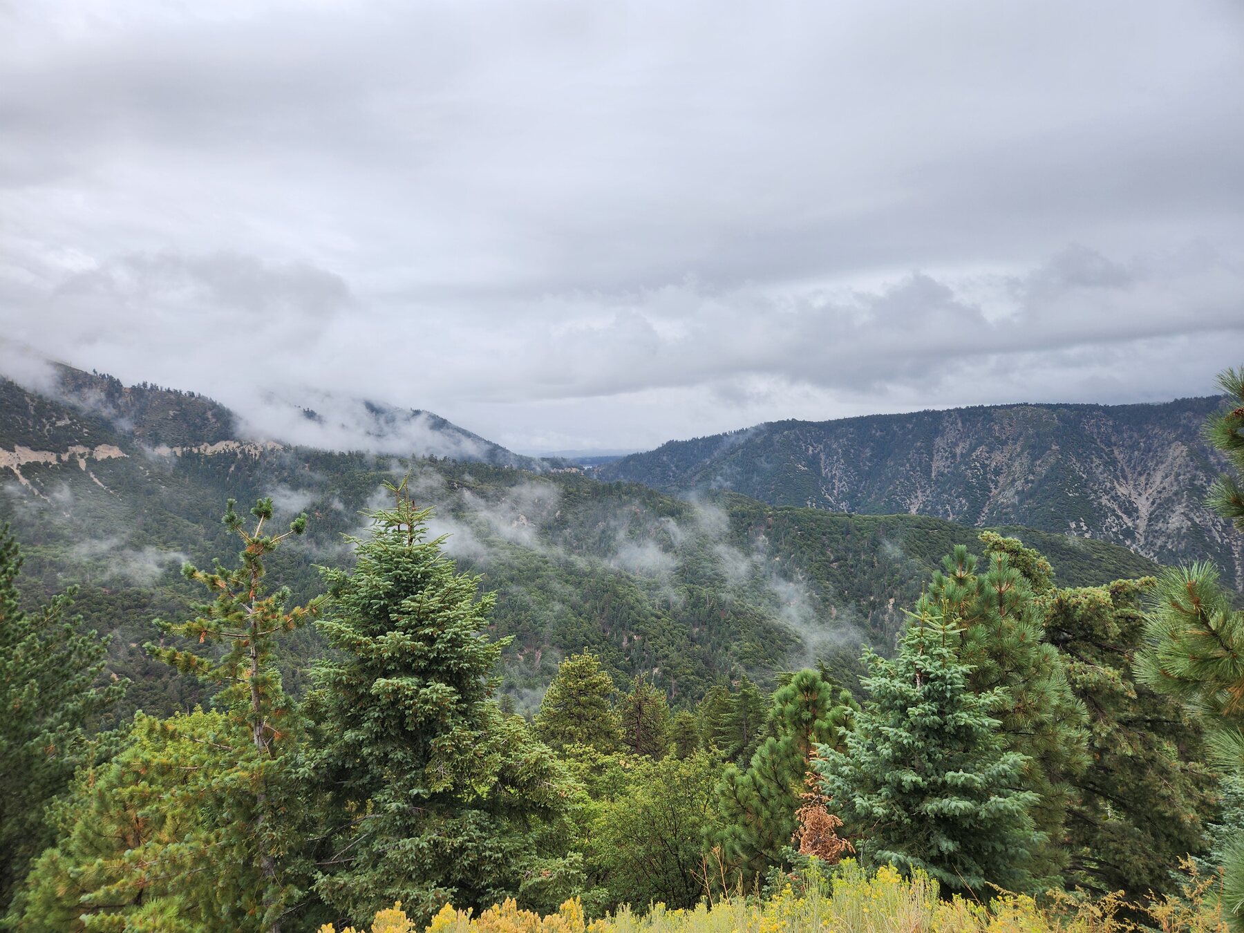 © Lindsey Thome
I stood at the top of the embankment soaking in the majestic scene. Just as I turned back toward the car, I heard a piercing screech high above me. I tilted my head up, instinctively looking for a large raptor. A moment later, I heard it again: “Keee-ahhhh,” the bird called from a distance. I quickly opened the Merlin Bird ID app on my phone and held it to the sky. When the call came again, the app identified what I suspected—a red-tailed hawk! I couldn’t have pictured a more quintessentially montane forest moment: ethereal mist filtering through the conifers and a hawk calling from beyond the visible sky.
Stop Three: Arrowbear 6,132 feet
After we passed the Snow Valley Ski Resort, the terrain changed. The montane forest persisted, but pines stood among immense dark boulders. Near Arrowbear, one pine rose from a seam between two slabs of rock; behind it, a small gnarled oak held lobed leaves that shone against the rain-darkened granite. I knew immediately that we had reached the next stop.
I turned to my husband. “Pull over!”
“Yes, ma’am.” He knew it was coming.
The turnout yielded a delightful variety of plants. Incense cedar still perfumed the wet air, but evergreen oaks had entered the canopy, accompanied by spiny redberry and wispy mountain mahogany. Mosses and soft green lichens occupied the granite, including cushion-like silver-green growth and vivid starry patches clinging in gravity-defying fashion to the boulder edges. A diminutive buckwheat glowed mint beneath the clouds. With the help of my twenty-first-century naturalist tools, I tentatively identified it as Kennedy’s buckwheat, a California endemic species.
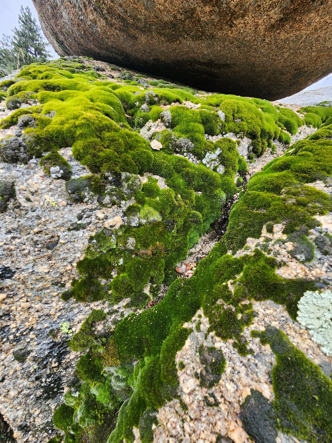 © Lindsey Thome
One oak appeared to be an oracle oak, a naturally occurring hybrid of California black oak and interior live oak. I would want clearer leaves and acorns before treating that identification as settled. What I could say with confidence was that the forest had become mixed: conifers and oaks were now speaking over one another.
Stop Four: Long Point 5,090 to 4,790 feet
We hopped back into the car and headed down Route 330. Near Long Point, we made two closely spaced stops: one to view unburned vegetation and another to see a recently burned slope. The first provided a baseline. Mature oaks and conifers occupied the steep terrain, but between them stretched a sparkling sea of California buckwheat, its flower heads fading from rose-gold to rust.
One pale green mound, nearly five feet tall, rose from the rust-tinged field. Like a beacon, the glowing green mound pulled my eye—and then the rest of me—down the wet slope. I edged from foothold to foothold, inching closer in hopes of identifying the plant. I passed a scrubby young oak on my descent that was far too small to catch me if I slipped. Looking back, it was probably safer to use the zoom on my camera to get a better look at the plant, but there was no going back. I was committed.
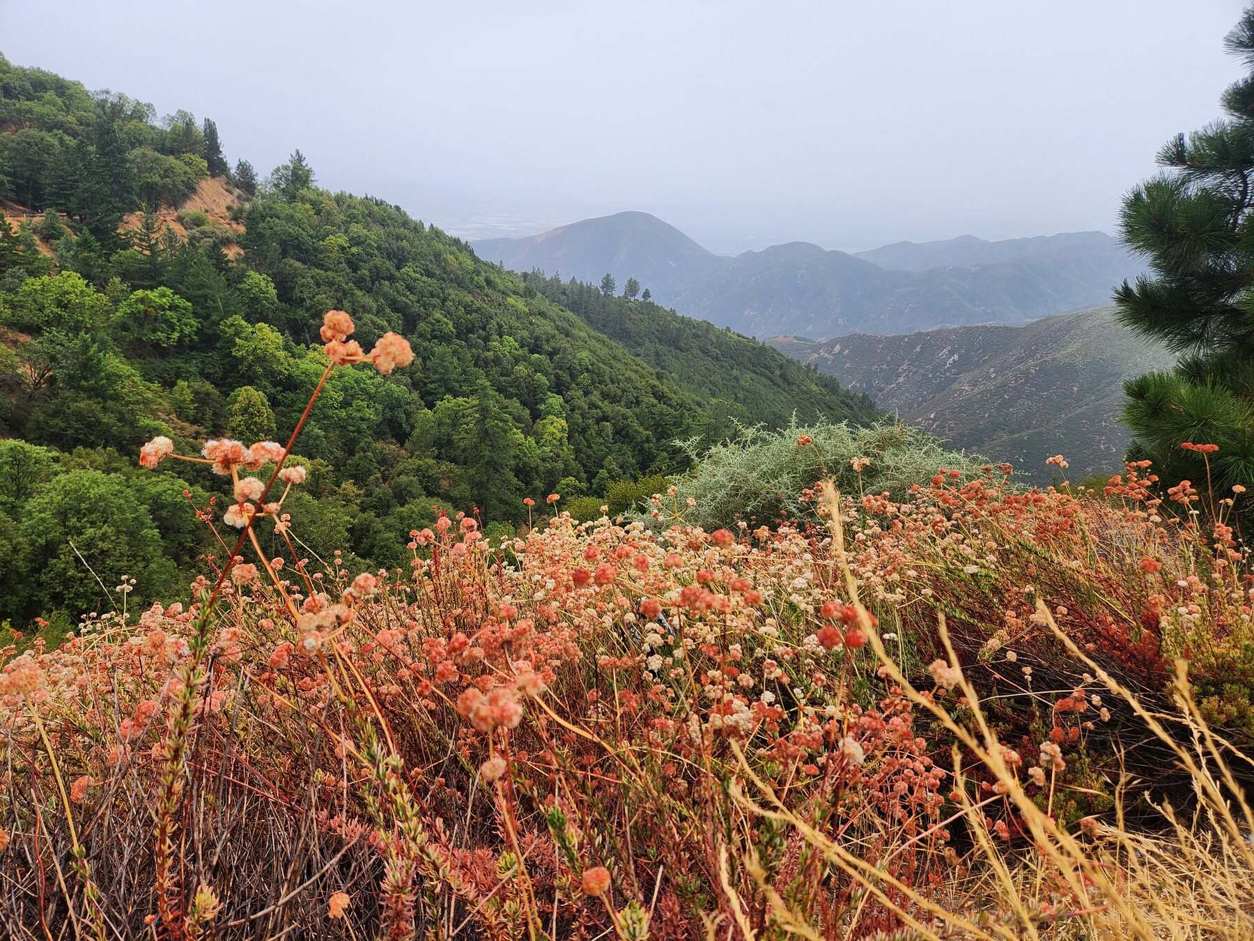 © Lindsey Thome
The mound resolved into chaparral whitethorn, its slender branches armed with white thorns. Beside it I found long-stemmed buckwheat, one of my favorites. The viewpoint revealed why the stop mattered: the slope was not simply “pine forest.” It was a mixed community of conifers, oaks, shrubs and flowering plants, each responding to its own combination of elevation, exposure and available moisture.
Around the next bend, charred trunks of pine, oak and manzanita rose from the hillside. We had dropped only a few hundred feet, but disturbance had altered the scene as decisively as elevation. There was no turnout, so we used a wide shoulder and kept the stop brief. The wet road and steep slope were reminders not to let botanical enthusiasm become a rescue operation.
This stop yielded a feast of fire-associated and recovering vegetation, including poodle-dog bush, green ephedra and what appeared to be southern bush monkeyflower. Bright green shoots sprouted from burls beneath blackened manzanita stems. Rust-colored buckwheat and orange-varnished granite punctuated the slope, along with small pale shrubs that appeared to be winterfat. Across the road, I could see what might have been yucca or beargrass, but a blind curve and intensifying rain ended that investigation. Some mysteries are best preserved by not getting hit by a car.
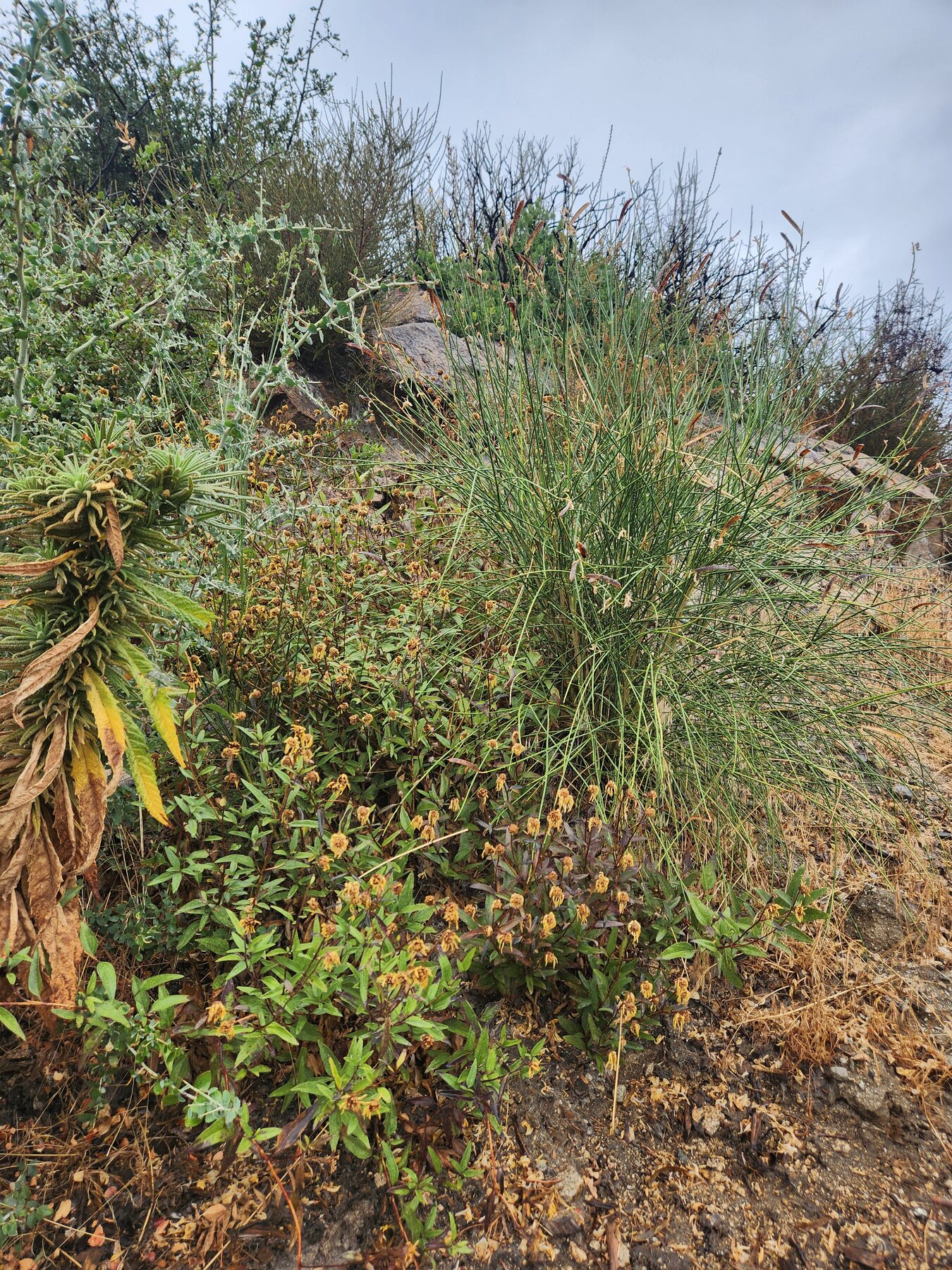 © Lindsey Thome
Stop Five: City Creek Fire Station 2,592 feet
“Ready for the last stop?” I asked as I climbed back into the car.
My husband visibly calculated whether sarcasm or a smile would be safer. He wisely chose the smile.
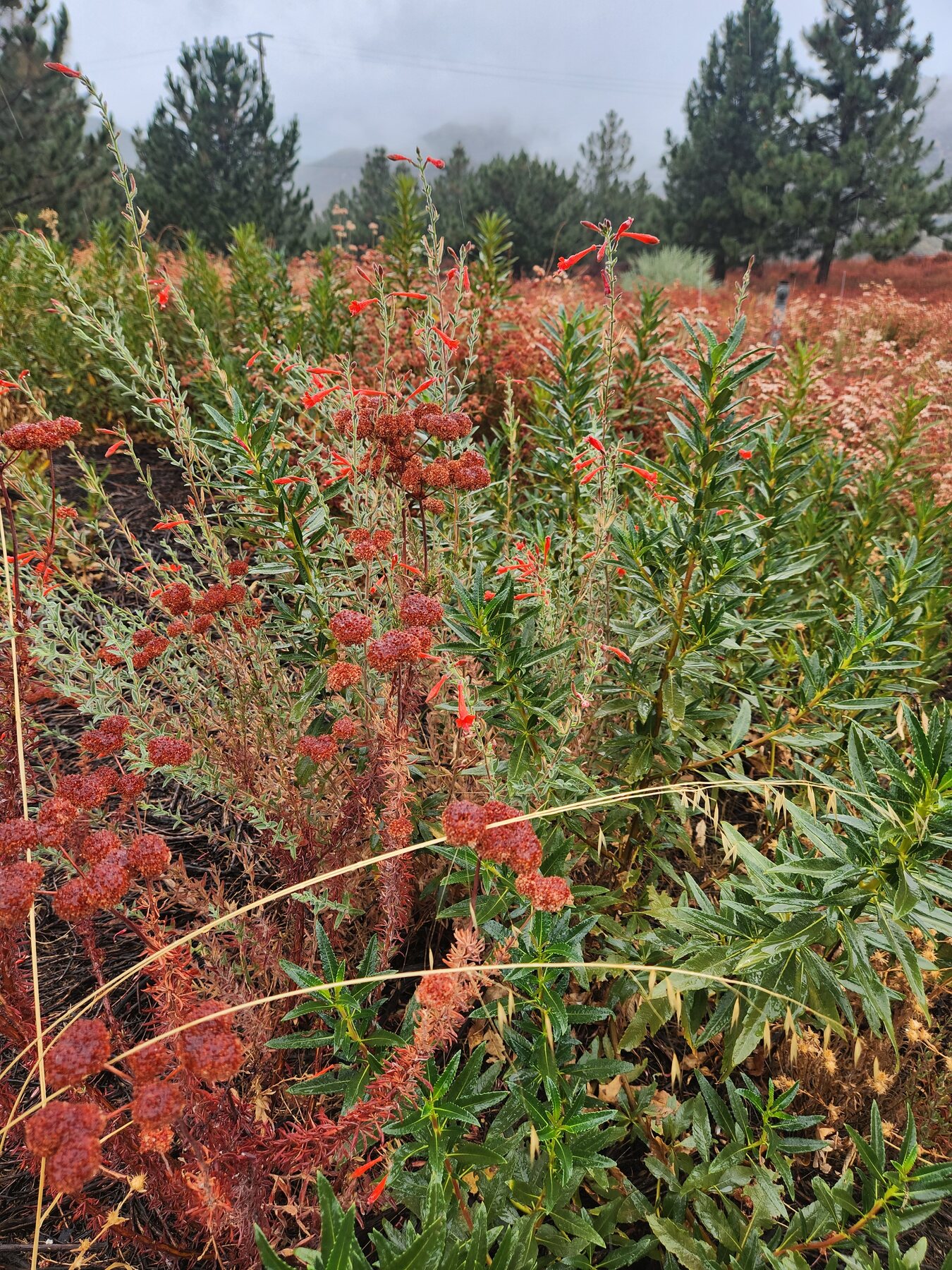
Fifteen minutes later, we pulled into the City Creek Fire Station at about 2,592 feet. Mist still moved through the folds of the mountains, but the landscape had opened. The slopes were light brown, stippled with dark green. Rain fell across a mosaic of rusty buckwheat, dry golden grasses and evergreen shrubs. A small stand of pines carpeted the ground with spent needles, but conifers no longer controlled the view.
This final stop produced the day’s most diverse plant list: sugar bush, California buckwheat, California aster, chaparral whitethorn, winterfat, beargrass or yucca, California everlasting, California fuchsia and poodle-dog bush. Some young evergreen oaks showed signs of stress, while some plants were still flowering; others had gone to seed or hardened into their late-summer forms. We saw firsthand that the chaparral was not the empty brown slope it can appear to be from a moving car. Up close, it was a crowded community speaking in an array of colors. The pine stand’s understory held one of the stop’s most interesting discoveries: yucca or beargrass—I couldn’t tell which—poking through a bed of fallen needles. It was a compact example of the overlap that defines an ecotone.
 © Lindsey Thome
One Watershed, Many Summers
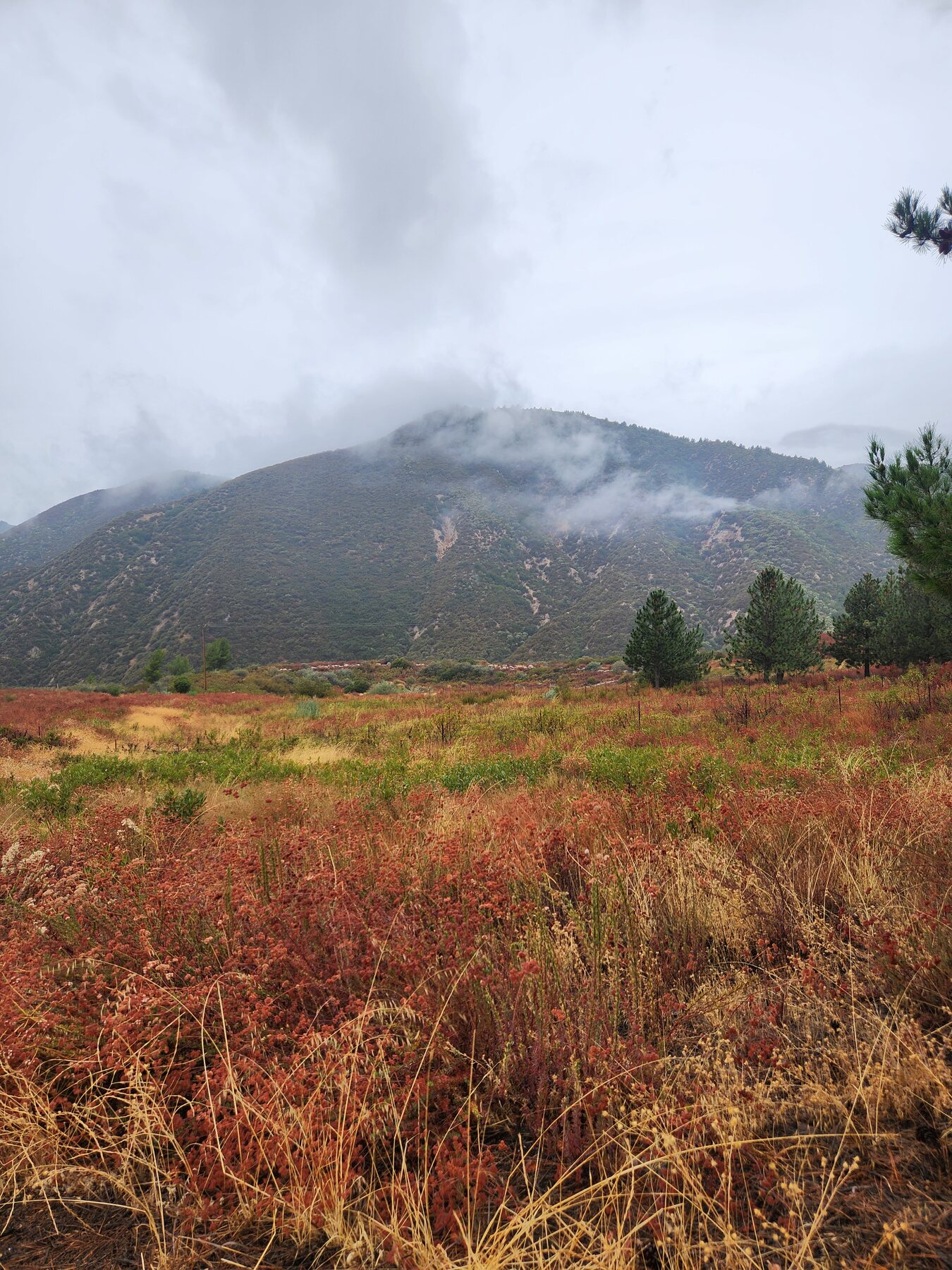
At the top of the mountain, deep summer meant wind on the lake, algae-green water, flowering rabbitbrush and conifers disappearing into rain. Near Arrowbear, moss and lichen softened granite beneath a mixed canopy. At Long Point, fire had reorganized the plant community within a few hundred vertical feet. By City Creek, the forest had yielded to chaparral, where late summer appeared not as absence but as a resilient tapestry of rust, seed, and hardened leaves.
The stops were not tidy borders between separate worlds. Oaks entered before the conifers departed. Chaparral shrubs appeared among trees. Fire, slope and exposure sometimes produced sharper changes than elevation itself. Ecotones underscore the continuity of life on the vertical calendar.
 © Lindsey Thome
That was the larger revelation of the drive. These were not five disconnected landscapes. They were different expressions of one watershed, stacked along the mountain. Water falling on the upper forest may eventually move through the same system I watch near Green River. Plants changed as we descended, but the journey between them was continuous.
The Patient Work usually asks me to return to one bend in the river and notice what time has changed. The vertical calendar asked a companion question: what changes when I keep the day nearly still and move through elevation instead? In one rainy descent, I watched several versions of September coexist—montane forest, oak woodland, burn scar and chaparral, each keeping deep summer in its own way.
What would you notice if you followed your own watershed from its highest point toward home?